PRISMA is the first European Satellite with a hyperspectral instrument and panchromatic camera on board. The #satellite was developed for the Agenzia Spaziale Italiana – ASI by a consortium with OHB Italia S.p.A. as Prime Contractor.
It was successfully launched atop a Vega launcher on March 2019 from Arianespace Spaceport in Kourou, French Guyana. Today PRISMA is fully operative on monitoring our Planet.
Since April 2020 free access to the system has been made available to the users community an average of five thousand spot #images per month. Moreover now the entire #catalog of PRISMA acquisitions (geographic/temporal coverage data) is available on the #GEOSS multimission portal and can be accessed without requiring any registration, thanks to the collaboration of National Research Council’s Institute on Atmospheric Pollution and ASI.
The catalog data are updated daily to ensure consistency between PRISMA acquisitions listed in the mission ground segment and the GEOSS portal (link: https://lnkd.in/dh4bTx4k)
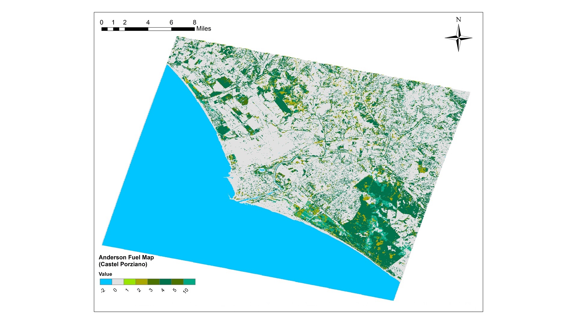
Hereabove a new interesting 30-km x 30-km spotlight acquisition of the Satellite: the #Castelporziano Nature Reserve, an important protected area covering 5892 hectares, located in the southern part of the “Litorale Romano”.
A Machine Learning model applied to the PRISMA image allowed to extract the #fuelmap over and around this area, exploiting the information contained in both the visible and near-infrared and shortwave infrared spectral regions.
Picture’s credits: Data/Information generated by e-GEOS and School of Aerospace Engineering (UNIROMA1), under an ASI License to Use; Original PRISMA Product – © ASI – (2021).